
TALA MINING GROUP has a total of 1.722 hectares in mining concessions, divided into 8 gold, copper and silver prospects, seven of them operated by TALA MINING GROUP ventures COMPAÑÍA MINERA INDIANA and COMPAÑÍA MINERA KUNZA. The seven prospects named “Atahualpa”, “Amanda”, “Botón de Oro”, “Berta”, Huanillos, “Indiana” and “Republicana” are located near Taltal (about 60 kilometers from the main city). The eighth prospect named “COMIPAL” is placed in Antofagasta and contains 2 copper mining properties in concession, “Paloma” and “Escondida”, both situated less than 15 minutes from the main city. The prospect is currently managed by TALA MINING GROUP in partnership with the ADAROS FAMILY GROUP through the venture COMIPAL (Compañía Minera Paloma de Portezuelos).
PROSPECTS LOCATED IN TALTAL
Taltal mining prospects can be classified into 3 main areas:
· · AMANDA: This is the closest prospect to the city of Taltal; its 25 kilometers away from the main city and less than 1 kilometer away from the “Route 5”, a main road.
· San José del Pingo: The prospects named “Atahualpa” and “Indiana” are located 40 kilometers southeast from the city of Taltal.
· Sierra Esmeralda: The prospects named “Berta”, “Botón de Oro” and “Republicana” are located 50-55 kilometers south of the city of Taltal, north from the “Quebrada La Cachina” and south from “Mantos de Huanillos”.

SIERRA ESMERALDA DISTRICT (Au-Cu-Ag)
This polymethallic mining district contains gold, silver and copper deposits and is located in the western area of the metallogenic belt in Chile’s Cordillera de la Costa, to the west side from the Atacama Fault. Historically, the district has presented works in the early 19th century by small scale mining projects with artisanal methods.
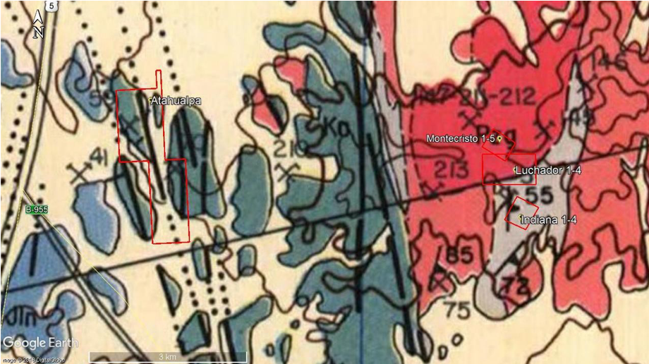
MINING DISTRICT SAN JOSE DEL PINGO (Au-Cu-Ag)
The prospects of this area are located at the south side of the Quebrada Cifuncho and north from Quebrada de la Cachina. “Atahualpa” property can be found to the west side of the “Indiana” property, with a 6 kilometers distance between them and 17.5 kilometers south from the “Amanda” prospect. At the “Atahualpa” prospect, the lithology corresponds to FM.Aeropuerto, while the “Indiana” prospect's lithology corresponds to rocks from the plutonic group of Cerro del Pingo and plutonic group of Cifuncho. All of these rocks are known locally for their veins with Au-Cu-Ag deposits.
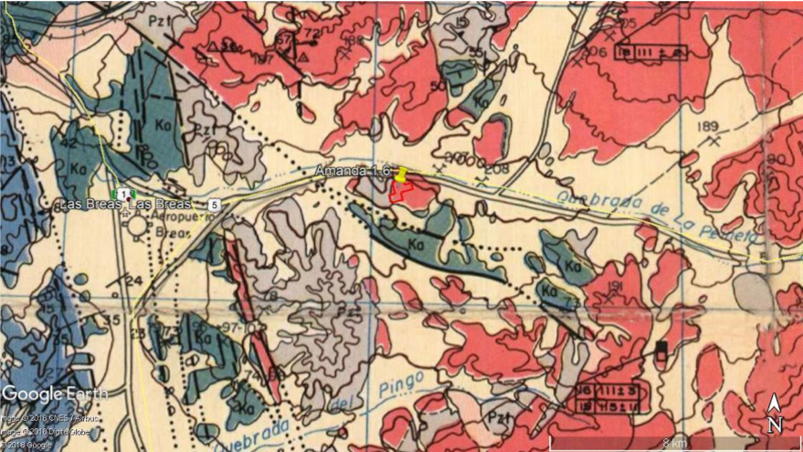
Amanda(Cu-Au)
Geographically located 25 kilometers southeast from the city of Taltal, 8.7 kilometers east from the Las Breas Aerodrome, placed south to “Route 5” main road and “Quebrada de la Peineta”, this area shows early works of exploitation from small and medium scale mining projects and different structural trends inductive signs to mineralization. Between the years 1986 and 1991, this property has had small scale gold extractions with an ore grade superior to 1 gram per ton. The works were made through a shaft and a ramp tunnel that could not be continued, due to financial problems.
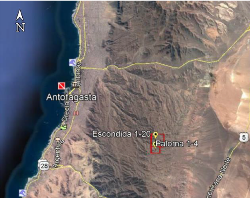
PROSPECT LOCATED IN ANTOFAGASTA
The COMIPAL mining prospect, managed by TALA MINING GROUP in partnership with the ADAROS FAMILY GROUP, is located less than 15 minutes from the city of Antofagasta and is constituted by 2 copper concessions:
a.- PALOMA 1 al 4 . Total area dimension: 35 hectares.
623 verso, No. 177.
b.- ESCONDIDA 1 al 20. Total area dimension: 100 hectares.
References about the Prospect
The two mining properties of the COMIPAL prospect are connected to each other and are situated 12 kilometers east of Antofagasta, on the eastern slope of the El Ancla hill range. To access the properties, you must use the “Route 5” main road in the section that connects “Salar del Carmen” with “La Negra,” taking the same road that leads to ENAMI’s purchasing agency office for about 5 kilometers and then turning west for about 5 kilometers more. The work on the properties has been exploited on a small scale using artisanal methods and at a superficial level. There are signs of excavation work in the area, with pits where copper oxides are manifested in a column of almost 30 meters positioned in the fault zone.
To the south of the area is the “Japón” mining project, which was exploited for many years and is now closed. The abandoned works' main structures and secondary mineralizations in the form of "baggages" can be seen, geomorphologically speaking. The area belongs to the La Negra Formation, and the rock is volcanic, composed of lavas, breccias, and andesitic agglomerations with a mantle to the west and intrusive cuts in the form of veins and mantles. In the intrusive bodies, there is a presence of sulfides, and superficial studies detected copper ore grades with values reaching 4% oxides and an average ore grade of 1% in relict sulfides in the area of the “Escondida” property. However, as stated by experts, these have not been properly studied and prospected.
In the past, COMIPAL properties were leased, and the former tenant developed an open-pit mining project with underground works.